
Written by Mike Ring, Vice President of Operations
Across the workforce, emerging trends in technology have been reshaping how people perform their roles—and the AEC industry is no exception. In our dynamic, hands-on industry, there are vast applications for the technological advancements we’ve observed, which often focus on safety and accessibility. Consider the possibilities of what AEC practitioners could achieve if only we could safely reach further. The use of drones, a recent major trend in our industry, has created an opening into that domain through aerial light detection and ranging (LiDAR).
Introducing Aerial LiDAR

Point cloud image produced from using aerial LiDAR over the Thornton Quarry in Thornton, IL.
Aerial LiDAR is used to create high-resolution 3D models of a project site, providing a detailed view of site conditions. The method involves mounting a LiDAR system (including a laser scanner, GPS, and Inertial Navigation System) on an aircraft, which then collects data by emitting laser pulses and measuring the time it takes for them to return. This data is used to generate point clouds and digital elevation models (DEMs), providing valuable information for various project applications. AEC practitioners can implement this method by using drones, allowing for the efficient mapping of hard-to-reach project areas (such as quarries and large open areas), monitoring of power lines and solar farms, performing time-based analysis, and monitoring volumes in stockpiles over a period of time—to name a few.
How We Use It
Our experts have been utilizing drones for some time to improve how we capture and understand sites. Aerial LiDAR has taken this much further, allowing us to minimize data collection time and increase the quantity of collected data where the application makes sense. Our Thornton Quarry project is one example of how this method can better support site assessment and approaches.
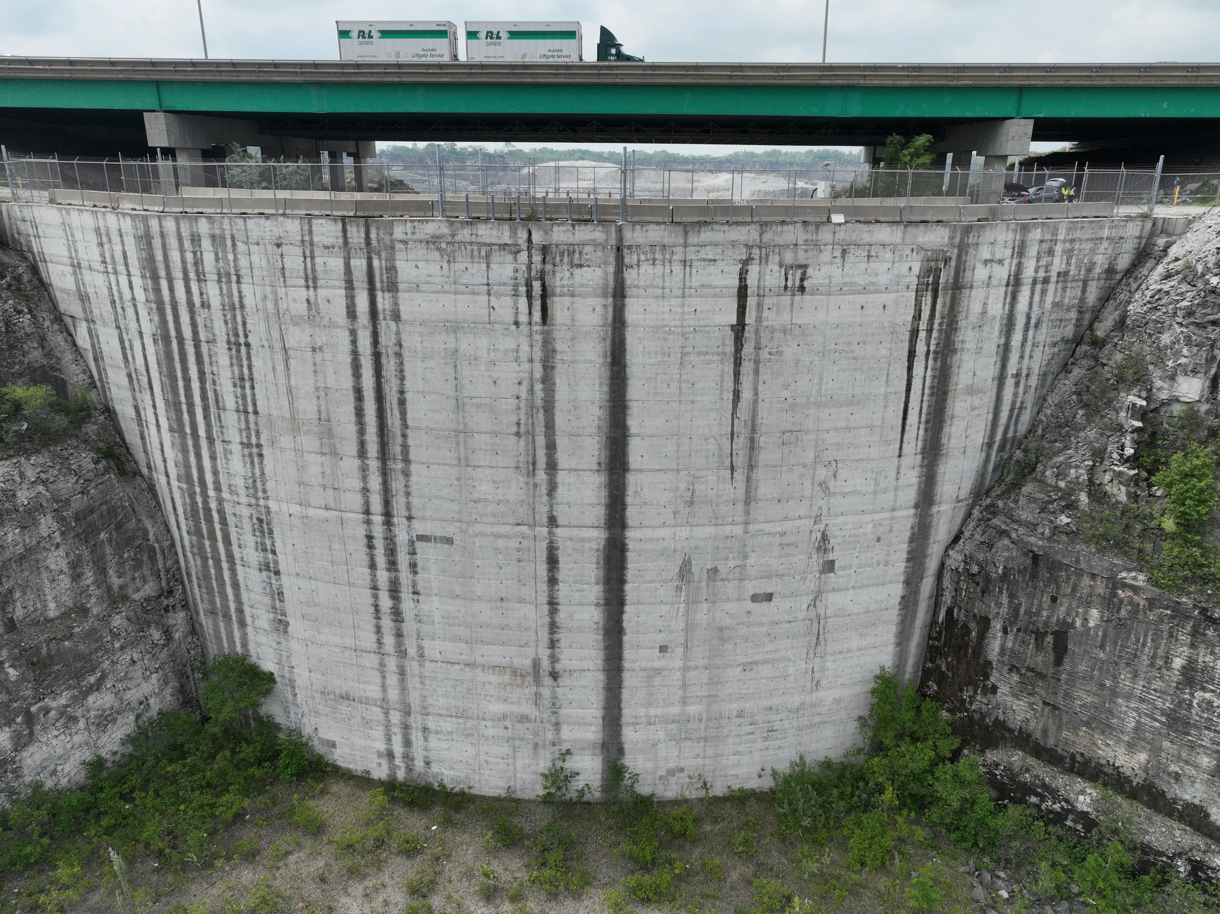
Drone image of the Thornton Quarry Gap Dam.
As water, and time, passes through the quarry and reservoir, there’s an expectation of wear. It’s critical to continuously monitor the dam for physical changes due to damage, deterioration, and performance issues–and the influence these changes have on the surrounding area. Because of the structure’s near-vertical faces of both the north and main lobes along the embankment carrying the Bishop Ford Expressway, aerial LiDAR was a logical choice for inspecting the Gap Dam and the anchors within the vertical faces, utilizing both aerial LiDAR and thermal imaging, along with using LiDAR to create a point cloud for a snapshot in time that can be used for comparison to future conditions.
TERRA is working as a subconsultant to Stantec for monitoring of the dam and reservoir walls, performing annual and fill event monitoring to ensure structural stability of this important piece of stormwater management (click here to read more).
Considerations for Aerial LiDAR Use
Considering the implementation of aerial LiDAR on one of your projects? Here are some tips to consider before making the call:
What is the deliverable you’re looking for?
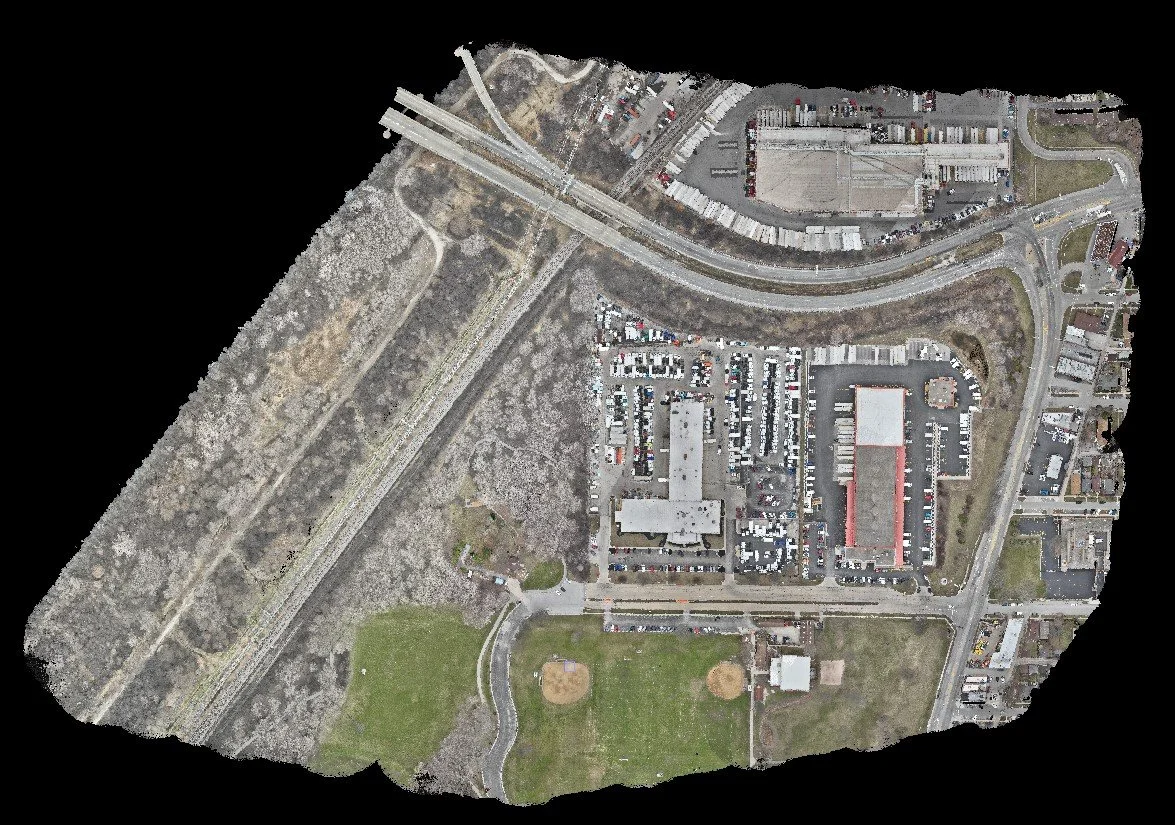
Aerial LiDAR point cloud from MWRD 71st Street project in Summit/Bedford Park, IL.
If a point cloud or DEM/DTM is what you need, aerial LiDAR could help you. If you’re only looking for aerial photos, traditional drone imagery is probably your best solution.
Is the area highly developed?
Highly developed areas can benefit from point cloud data collection. Under- or undeveloped areas might benefit from photogrammetric methods to produce a DEM/DTM due to the reduced data extraction time.
Is the area below tree cover?
Tree cover might be a consideration driving the time of year for data acquisition. Fall/winter, when leaves are not on deciduous trees, would be easier for LiDAR data acquisition. Data acquisition via LiDAR can be done during leaf-on seasons but will require more data extraction to filter out the last return signals.
Does your project site allow for drone use?
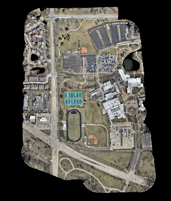
Aerial LiDAR point cloud from Harper College Athletic Fields project in Palatine, IL.
It’s critical to know what method of LiDAR is most practical for your site, as not all project sites will call for aerial LiDAR. For example, TERRA used terrestrial LiDAR inside O’Hare Terminal 5 to analyze building interiors and under structures where drones cannot fly or access.
To recap, aerial LiDAR is a practical approach to safely and efficiently mapping and monitoring a vast project site, especially when detailed output and information of the site is needed. When applied to our Thornton Quarry project, we observed the following benefits:
Increased data collection over a smaller period of time
Increased access and safety
More data, reducing the need to return to the site too frequently
Incorporation of more visual data (orthophotos and point clouds) to help convey site information
TERRA values and highlights the importance of staying aware of emerging trends in our industry and how they can better inform each project to help us better serve each community. Interested in learning more? We can help.